
onX Hunt: Offline Hunting Maps
Overview
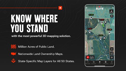
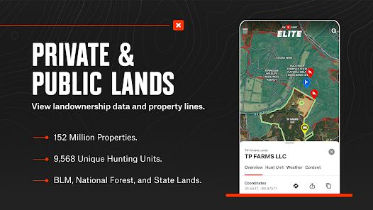
The application onX Hunt represents the pinnacle of digital mapping for the North American hunting community. As a specialized GPS tool, onX Hunt addresses a fundamental challenge: the accurate identification of land boundaries between public wilderness and private estates. In a landscape where trespassing can lead to legal complications, onX Hunt provides hunters with a definitive "Land Ownership" layer that includes property lines and the names of landowners across all 50 U.S. states.
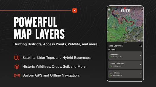
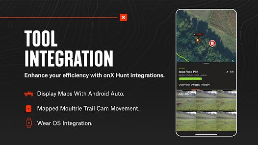
The feature breakdown reveals a highly sophisticated GIS (Geographic Information System) infrastructure. The app offers a variety of basemaps, including "Lidar Topo," "Satellite," and "Hybrid," which allow for detailed "e-scouting" of terrain. A standout 2026 feature is the "TerrainX 3D Viewer," which renders topography in three dimensions, helping hunters visualize ridge lines and game funnels before they step into the field. Furthermore, the app integrates with vehicle dashboards via Android Auto, allowing for hands-free navigation on complex forest service roads.
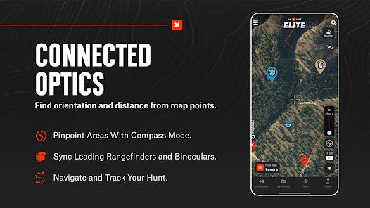
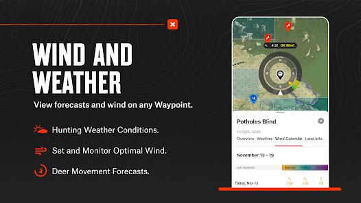
An insightful observation regarding onX Hunt's ecosystem is its integration with hardware. The app can synchronize with rangefinders and binoculars, automatically "dropping waypoints" on the map based on where the hunter is looking. This hardware-software synergy allows for real-time mapping of game sightings without the need for manual data entry. Additionally, the "Deer Movement Forecasts" use predictive analytics based on weather and barometric pressure to suggest the optimal times for a hunt.
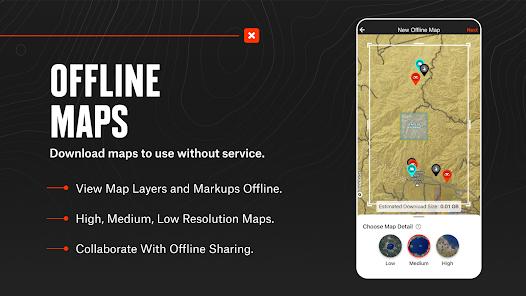
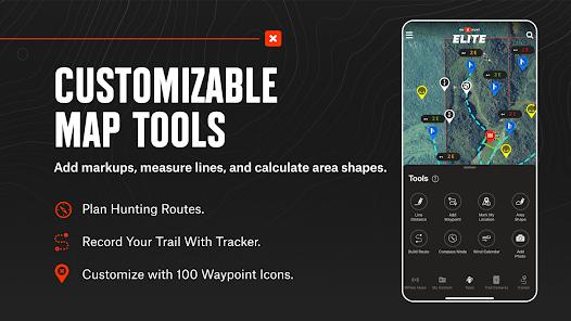
Technologically, the app's most critical feature is its "Offline Maps" capability. Since hunting often occurs in remote areas with zero cellular reception, onX Hunt allows users to download large tiles of data to their device’s internal storage, maintaining full GPS functionality in the deep wilderness. This is supported by a "Tracker" function that records the hunter’s path, ensuring they can safely navigate back to their trailhead after dark.
Pros & Cons
Definitive land ownership data provides property lines and landowner names, which is essential for legal compliance and obtaining hunting access.
Superior offline mapping capabilities allow for high-resolution GPS navigation in areas completely devoid of cellular service.
Advanced terrain analysis layers, including Lidar and 3D viewing, offer a professional-grade e-scouting experience from a desktop or mobile device.
Seamless integration with Android Auto and hardware like Moultrie trail cameras creates a unified "Hunt Tech" ecosystem.
"Optimal Wind" waypoints allow hunters to mark stands and blinds and receive alerts when the wind direction is favorable for a specific location.
A robust "Tracker" tool records your path, speed, and distance, serving as a critical safety feature for deep-woods navigation.
- ✕
The "Elite" membership, which provides nationwide coverage and recent imagery, is expensive at approximately $100 per year.
- ✕
The road and trail data for very remote areas can occasionally be outdated, requiring users to cross-reference with local knowledge.
- ✕
High-resolution 3D mapping and continuous GPS tracking can lead to significant battery drain on older mobile devices.
Download


FAQs
How accurate are the property lines in onX Hunt?
The data is pulled from official county tax records; while generally highly accurate, users should always look for physical boundary markers in the field.
What happens if I cross into Canada?
OnX Hunt offers Canadian maps as part of its Premium+ and Elite memberships, covering various provinces and territories.
Can I use the app for fishing?
While primarily for hunting, the topographic maps and public access points are highly useful for anglers, and the "TroutRoutes" integration is a common add-on.
Do I need a separate GPS device?
For most hunters, a modern smartphone running onX Hunt in offline mode replaces the need for a standalone GPS unit.
How do I share a "Hunt Area" with a friend?
You can select a saved waypoint or area and use the "Share" function to send the exact coordinates to another onX user.
Hot Reviews
Hunters frequently state that they "won't hunt without it," citing the peace of mind that comes from knowing exactly where public land ends and private property begins.
Reviews highlight the 3D desktop viewer as a "game changer" for western hunting, allowing for the scouting of massive mountain ranges from the comfort of home.
Some recent feedback mentions that the Android Auto integration can sometimes "freeze or zoom out" unexpectedly, requiring a manual restart of the app while driving.